• Explore Categories
    • Living Planet
    • People & Patterns
    • Natural Wonders
    • Odds & Ends
    • Behind the Map
Subscribe
Search Form
No Result
View More Search Results

Where Do Communities Border Wildlands?

by Robby Deming
August 15, 2024
People & Patterns
Map of Europe showing wildland-urban interface areas.

Since 2000, the US alone has experienced 18 different wildfire events that have caused more than $1 billion in damage. Many were in places where development intertwines with more rural and wild spaces. These areas are known as the wildland-urban interface (WUI).

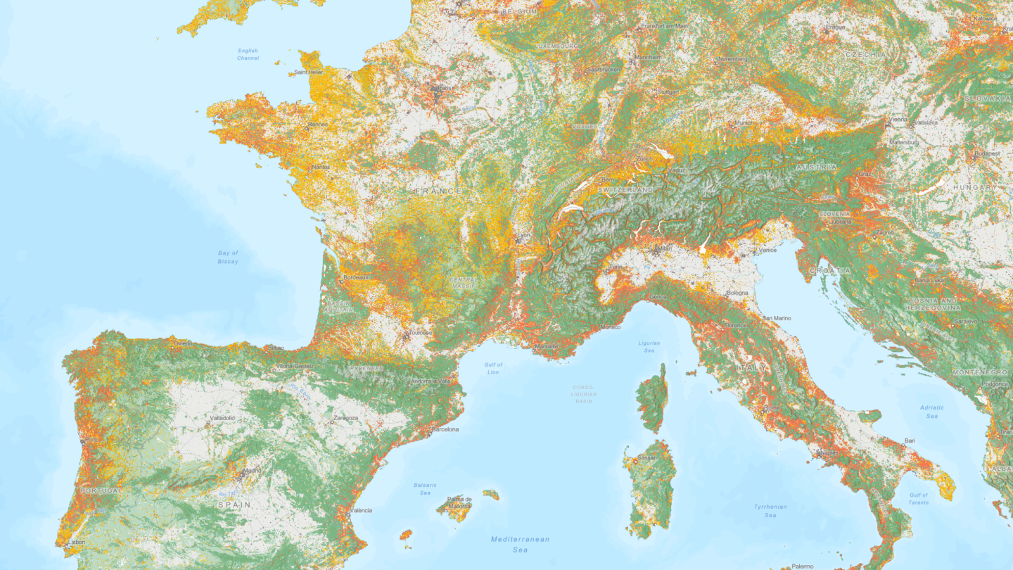
This interactive map from Esri documents WUI on a global scale. Built on data from the SILVIS Lab at the University of Wisconsin-Madison, it shows where development intersects with forests, shrubs, wetlands, and grasslands.

This striking map makes it clear where human activities and wildlands collide. Vibrant oranges and yellows show places where development has encroached into wildlands. Paler yellows and oranges show where development is near wild areas.

It’s important to note that WUI doesn’t represent fire risk, but it does show fire potential. Wildfire risk depends on climate and other considerations. Still, areas where development and vegetation mix have a higher overall potential for wildfire.

Map showing WUI around Lahaina in Hawaii
Areas around Lahaina, Hawaii, are part of the wildland-urban interface. (Source: Esri)

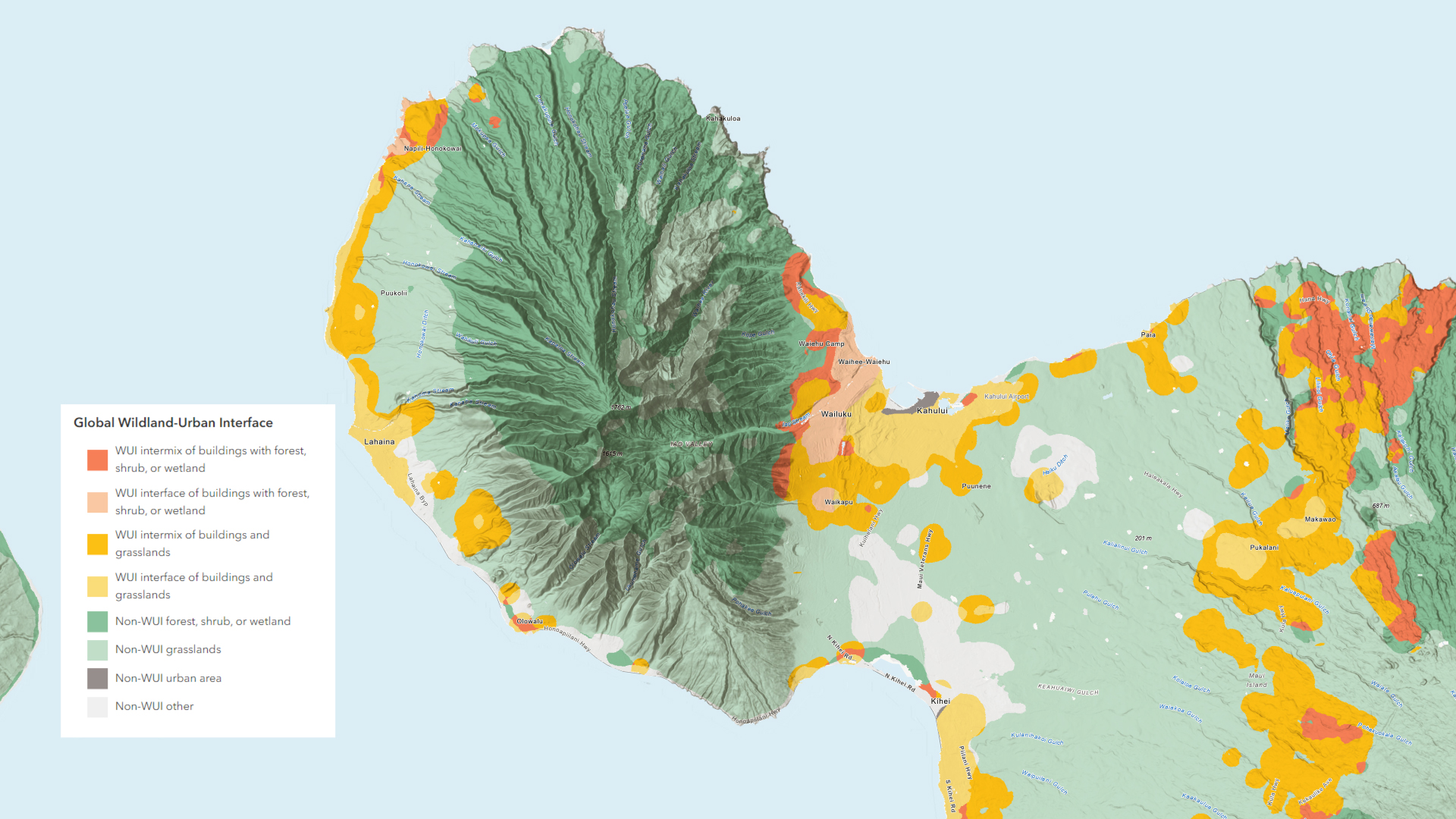
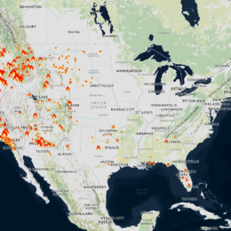
You can see WUI in places that have experienced destructive fires in recent years. This includes Paradise, California, and Hawaii. However, in the US, WUI is far more prevalent in the eastern part of the country where wildfires are less common.

There are pockets of WUI on nearly every continent. Western Europe is dotted with WUI, and several countries in eastern Africa, including Kenya, Uganda, and Tanzania, have large WUI areas. Parts of Indonesia and western China have abundant WUI areas. Despite being home to the largest population in the world, India actually has relatively few WUI areas.

Maps like this can help policymakers prioritize wildfire mitigation efforts. They also help communities understand how critical infrastructure like hospitals interact with wildlands. As development pushes further into wild areas, these insights can improve resilience.

Global Wildland-Urban Interface

See where communities collide with wildlands.
Explore the Interactive Map

More to Explore

  • Learn more about how this interactive map was made.
  • See where fires have burned globally in recent years.

About This Map

Title
Global Wildland-Urban Interface
Creator
Esri
Data Sources

SILVIS Lab at the University of Wisconsin-Madison

Tags
Disasters Interactive Wildfires
Share This Article

Keep Exploring

An illustrated map of Minnesota.

Magnificent Minnesota

September 3, 2024
Odds & Ends
Abstract Agriculture Reference
Map showing school districts symbolized by percentage of students of color.

How Do School District Boundaries Impact Students?

June 17, 2024
People & Patterns
Education Equity Explainer
Map of western United States showing drought intensity from Climate Mapping for Resilience and Adaptation Portal

Which Climate Hazards Threaten Your Community?

October 16, 2023
Living Planet
Climate Change Interactive Resilience
View More Maps
Next Post
Map of active wildfires in the US

How Are Active Wildfires Impacting Communities and Environments?

August 15, 2024 Living Planet

Maps.com
Explore Today.
Create Tomorrow.
  • About Maps.com
  • Submit a Map
  • Contact
  • Legal
  • Privacy
  • Media Use
  • Manage Cookies
  • Do Not Share My Personal Information
  • Legal
  • Privacy
  • Media Use
  • Manage Cookies
  • Do Not Share My Personal Information
  • Categories
    • Living Planet
    • People & Patterns
    • Natural Wonders
    • Odds & Ends
    • Behind the Map
  • About
  • Submit Map
  • Contact Us
Subscribe

  • Legal
  • Privacy
  • Media Use
  • Manage Cookies
  • Do Not Share My Personal Information

Add New Playlist

  • Categories
    • Living Planet
    • People & Patterns
    • Natural Wonders
    • Odds & Ends
    • Behind the Map
  • About
  • Submit Map
  • Contact Us
Subscribe

  • Legal
  • Privacy
  • Media Use
  • Manage Cookies
  • Do Not Share My Personal Information

Thank you!

We have received your request and will send updates about Maps.com to your email:

Continue reading article

Sign Up For Updates

Skip to content