• Explore Categories
    • Living Planet
    • People & Patterns
    • Natural Wonders
    • Odds & Ends
    • Behind the Map
Subscribe
Search Form
No Result
View More Search Results

Where Did Dinosaurs Once Roam Earth?

by Robby Deming
January 30, 2025
Odds & Ends

Fossils, like historical maps, are relics of a past we can still learn from today. They capture a snapshot in time of Earth as it once was. Through study, we can unlock details about the organisms, climate, and geography of our planet in the distant past. And few fossils capture our imagination quite like those of the dinosaurs who lived millions of years ago.

This interactive map from Warren Davison at Esri highlights some places where dinosaur fossils have been found. Dinosaurs have been found on every continent, including Antarctica. This map provides a deeper dive into some of those discoveries.

Digging Up Dinosaurs

See where dinosaur fossils have been discovered for 14 different species.
Explore the Interactive Map

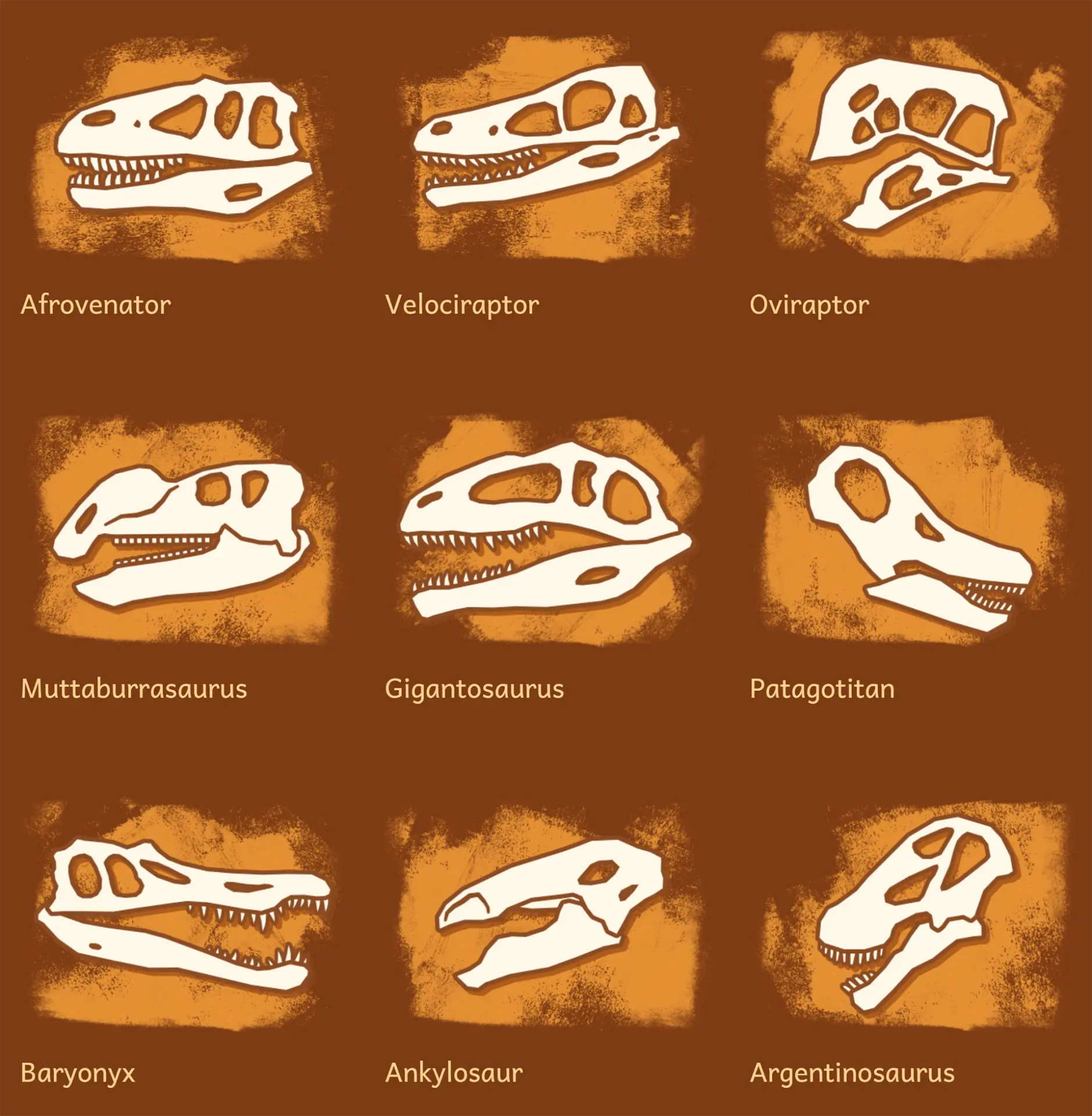
Each fossil location includes the name of the species discovered. You can also explore a stylized sketch of the species’ skull and learn more about both the species and the fossil. The map chronicles fossils for 14 dinosaur species discovered between 1861 and 2014.

Along the way, custom sketches, animations, and fonts draw readers in. The overall structure echoes the process of an archaeologist digging deeper to uncover some new detail or insight. Explainers of the fossilization process and the evolution of Earth’s land masses both educate and delight. The result is an engaging experience that’s as much fun as it is informative.

Article dinosaurs asset
The map highlights the locations of fossils for more than a dozen dinosaur species. (Source: Esri)

More to Explore

  • Dig deep into a map of Earth’s ancient past.
  • Learn how climate change is leading to the discoveries of new dinosaur fossils.

About This Map

Title
Digging Up Dinosaurs
Creator
Warren Davison, Esri
Tags
Explainer Historical Interactive
Share This Article

Keep Exploring

A rendering of Earth's continents as they might have been during the Devonian period, 400 million years ago.

Peer into Earth’s Ancient Past

January 3, 2024
Living Planet
Geology Historical Interfaces
Carbon dioxide in the atmosphere, concentrating over the northern hemisphere and areas of human population.

Watch a Year in the Life of Earth’s Carbon Dioxide

July 8, 2024
Living Planet
Air Quality Animated Maps Climate Change
Map of Earth showing satellites orbiting the planet.

Tracking Earth’s Vital Signs

October 24, 2024
Living Planet
Interactive NASA Satellites
View More Maps
Next Post
Zoomed in view of Egypt Old Cairo map.

Back to the Map: Egypt Old Cairo

January 30, 2025 Behind the Map

Maps.com
Explore Today.
Create Tomorrow.
  • About Maps.com
  • Submit a Map
  • Contact
  • Legal
  • Privacy
  • Media Use
  • Manage Cookies
  • Do Not Share My Personal Information
  • Legal
  • Privacy
  • Media Use
  • Manage Cookies
  • Do Not Share My Personal Information
  • Categories
    • Living Planet
    • People & Patterns
    • Natural Wonders
    • Odds & Ends
    • Behind the Map
  • About
  • Submit Map
  • Contact Us
Subscribe

  • Legal
  • Privacy
  • Media Use
  • Manage Cookies
  • Do Not Share My Personal Information

Add New Playlist

  • Categories
    • Living Planet
    • People & Patterns
    • Natural Wonders
    • Odds & Ends
    • Behind the Map
  • About
  • Submit Map
  • Contact Us
Subscribe

  • Legal
  • Privacy
  • Media Use
  • Manage Cookies
  • Do Not Share My Personal Information

Thank you!

We have received your request and will send updates about Maps.com to your email:

Continue reading article

Sign Up For Updates

Skip to content