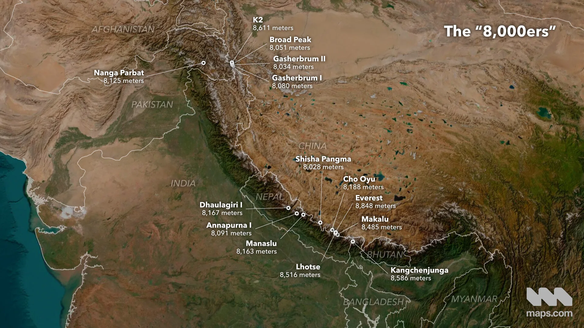
Mount Everest, known as Sagarmatha in Nepal and Qomolangma in Tibet, has long been a target for thrill seekers, climbers, and adventurers. Climbing Earth’s tallest mountain can be a dangerous expedition, as it’s claimed the lives of more than 200 people. Although Everest gets most of the attention, it’s not the only mountain in the region that climbers covet. The most daring and adventurous climbers aim for the “8000ers,” a group of 14 different mountain peaks taller than 8,000 meters. Fewer than 100 people have managed to summit all 14 peaks.
This animated map tours the 8000ers, showing their locations and unique topography. It relies on data from 8000ers.com, as well as NASADEM elevation data and imagery curated by Esri to bring the peaks to life.
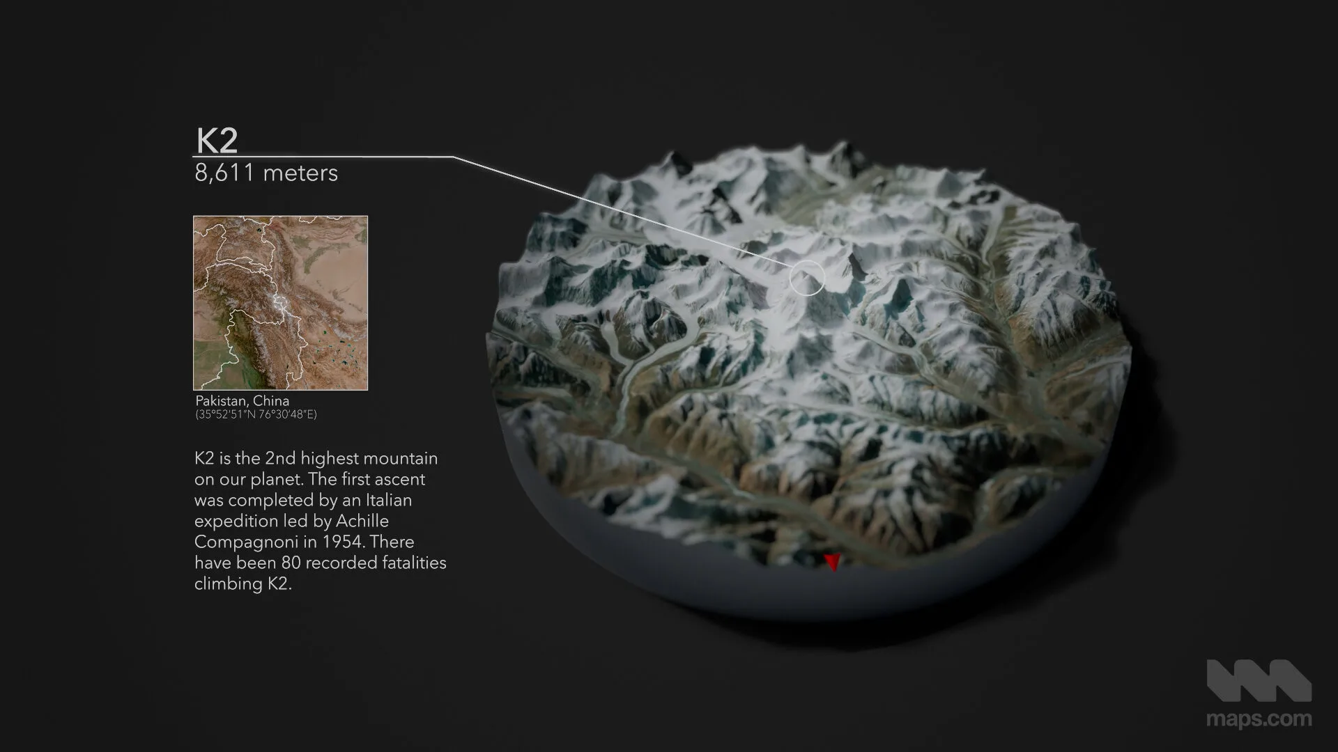
Explore a rotating diorama highlighting the topography and terrain of each of the 14 mountains. (Source: Maps.com)
Each peak is animated as a 3D, 360-degree diorama. Ordered from the shortest (Shisha Pangma, at 8,027 meters or 26,335 feet) to the tallest (Everest, at 8,848 meters, or 29,029 feet), the dioramas showcase the unique topography of each mountain. You can see snow and ice, glaciers, alpine lakes, vegetation, and rocky terrain. There’s a surprising amount of diversity in shape and land cover across the two ranges where the 8000ers can be found. You can also get a sense of the geological processes that shaped each area. A red arrow on each diorama helps to orient viewers by indicating north.
The dioramas also include information about each peak. Besides name and height, the map lists the coordinates and countries where each mountain is located. You can also discover who first summited each mountain and when, as well as the number of fatalities recorded on each peak. While Everest has seen the most fatalities, Nanga Parbat and K2 have also claimed 80 or more lives.
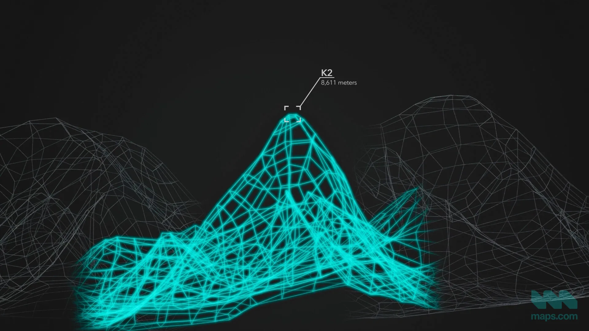
Compare each peak’s shape and relative height, from shortest to tallest. (Source: Maps.com)
The video ends with stylized wireframes comparing each mountain’s shape and height. They reveal the scale of these towering mountains, as well as the varied topography climbers face.
Most of us will never climb one, let alone all 14 of the 8000ers. But this animated map highlights the immense challenges and soaring heights for those who do.
The 8000ers cluster in the Karakoram range in the north and the Himalayas in the south. (Source: Maps.com)