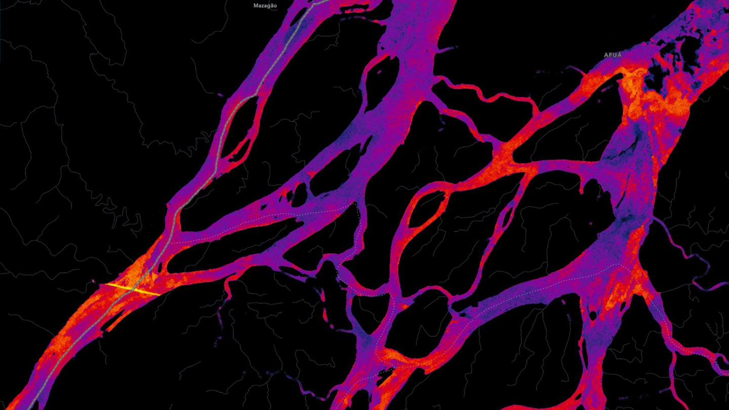
Remotely sensed imagery has allowed us to see Earth in rich detail. But a lot of imagery that gets captured by satellites is obscured by clouds or smoke. The ability to see Earth’s surface also requires light. Sensors like those used by the Copernicus Sentinel-1 mission produce a different kind of imagery called synthetic aperture radar (SAR). Unlike optical sensors, SAR can record images through any type of weather, day or night. Those same capabilities also enable SAR to detect water depths and differentiate tree canopies from land.
This interactive map from Esri uses Sentinel-1 imagery to produce a new view of Earth. With this map, we can use SAR data to measure flood impacts, see through wildfire smoke, and track the movement of objects such as ships and sea ice, no matter the weather.
When you open the map, you can explore the most recent SAR imagery for any place on Earth. Unlike a color photograph, SAR data measures radar energy reflected to the sensor. Typically, SAR imagery is shown in black-and-white to visualize these measurements. This map uses different renderers to help make the imagery more intuitive. You can also pick a visualization to highlight different features, such as water depths or water anomalies.
Like optical imagery, SAR data can be compared over time. You can browse imagery from 2014 to 2024 and filter images by orbit direction (important for ensuring consistent comparisons over time). In the map, you can compare two images via a swipe tool or animate a series of images over time and place.
For example, consider the breach of the Kakhovka Dam in June 2023. In these before-and-after images, you can see how the dam’s destruction caused downstream flooding along the Dnieper River near Kherson, Ukraine. In the before images, water depths are highest in the reservoir in the northeast. After the dam is breached, water levels plummet in the reservoir but rise downstream. You can also see evidence of flooding beyond the banks of the river.
In addition to flooding, SAR can better detect oil spills or pollutants in water. It can reveal vessel congestion around ports and waterways and can be used to navigate and track sea ice. SAR imagery helps us fill in the gaps optical imagery can’t capture and unlocks new ways to measure and monitor Earth.
More to Explore
- Check out a SAR map of Cedar Point and its roller coasters.
- Learn more about SAR and how it’s used.