• Explore Categories
    • Living Planet
    • People & Patterns
    • Natural Wonders
    • Odds & Ends
    • Behind the Map
Subscribe
Search Form
No Result
View More Search Results

Animating Earth’s Aerosols

by Joshua Stevens
January 23, 2024
Living Planet

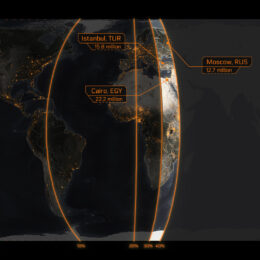
With currents in the air, over land, and at sea, Earth is an intricately connected system of systems. Much of the human world was on pause during 2020 due to the COVID-19 pandemic, but Earth’s systems continued apace as they have for millennia. These dynamic connections are on full display in global aerosol patterns. Once airborne, particles like dust, black carbon, and sea salt can travel across continents and over oceans.

Using data from the National Aeronautics and Space Administration (NASA) Global Modeling and Assimilation Office (GMAO)—and inspiration from NASA’s Earth Observatory—this animation sheds light on the patterns behind aerosol transport. The data are from the GEOS-5 model. This model combines equations with measurements from satellites, aircraft sensors, and instruments on Earth’s surface. GEOS-5 uses the input to simulate real-world conditions several times a day, and it does so remarkably well.

Watch as the Amazon Rainforest receives dust carried from the Saharan Desert. Observe tropical depressions form, dissolve, or grow into powerful hurricanes over the Atlantic Ocean. And witness the 2019–2020 Australian wildfires consume eucalyptus forests, sending smoke high into the stratosphere where it ultimately circumnavigated the planet.

By The Numbers

182 Million

tons of dust cross the Atlantic each year, 15% of it reaching the Amazon

46 Million

 acres were burned during the 2019-2020 Australian wildfires

30

named storms during the 2020 Atlantic hurricane season set a new record

About This Map

Title
Animated Maps: Global Aerosols
Creator
Rich Spencer and Charlie Lott, Maps.com
Data Sources

NASA GMAO GEOS-5 FP Model, NASA Black Marble

Original Map

This original map was created by the Maps.com team. It is available for you to use in accordance with our media use policy.

Tags
Air Quality Animated Maps Hurricanes NASA Original Satellites Wildfires
Share This Article

Keep Exploring

Chlorophyll is just one of the pigments found in plants.

See a Palette of Pigments from Space

September 8, 2025
Living Planet
Animated Maps Biosphere NASA
Satellite imagery showing land, clouds, and water temperature.

A View of Our World Like No Other

April 15, 2024
Living Planet
Imagery Interactive Interfaces
Map of Canada showing active wildfires in 2023.

How Widespread Was Canada’s Historic 2023 Wildfire Season?

December 11, 2023
Living Planet
Animated Maps Submitted Map Wildfires
View More Maps
Next Post
Population density map of Earth by longitude

Where on Earth Do Most People Live?

January 23, 2024 People & Patterns

Maps.com
Explore Today.
Create Tomorrow.
  • About Maps.com
  • Submit a Map
  • Contact
  • Legal
  • Privacy
  • Media Use
  • Manage Cookies
  • Do Not Share My Personal Information
  • Legal
  • Privacy
  • Media Use
  • Manage Cookies
  • Do Not Share My Personal Information
  • Categories
    • Living Planet
    • People & Patterns
    • Natural Wonders
    • Odds & Ends
    • Behind the Map
  • About
  • Submit Map
  • Contact Us
Subscribe

  • Legal
  • Privacy
  • Media Use
  • Manage Cookies
  • Do Not Share My Personal Information

Add New Playlist

  • Categories
    • Living Planet
    • People & Patterns
    • Natural Wonders
    • Odds & Ends
    • Behind the Map
  • About
  • Submit Map
  • Contact Us
Subscribe

  • Legal
  • Privacy
  • Media Use
  • Manage Cookies
  • Do Not Share My Personal Information

Thank you!

We have received your request and will send updates about Maps.com to your email:

Continue reading article

Sign Up For Updates

Skip to content