There is no single, prescriptive way to produce a map. Over centuries, maps have been carved into tablets and walls, woven into tapestries, painted on animal skins, etched into plates, printed in books, and more. Modern technology has supplemented these methods with programmatic and digital-first approaches to mapmaking. Today’s cartographers have more options than ever before. And some are blending them to great effect.
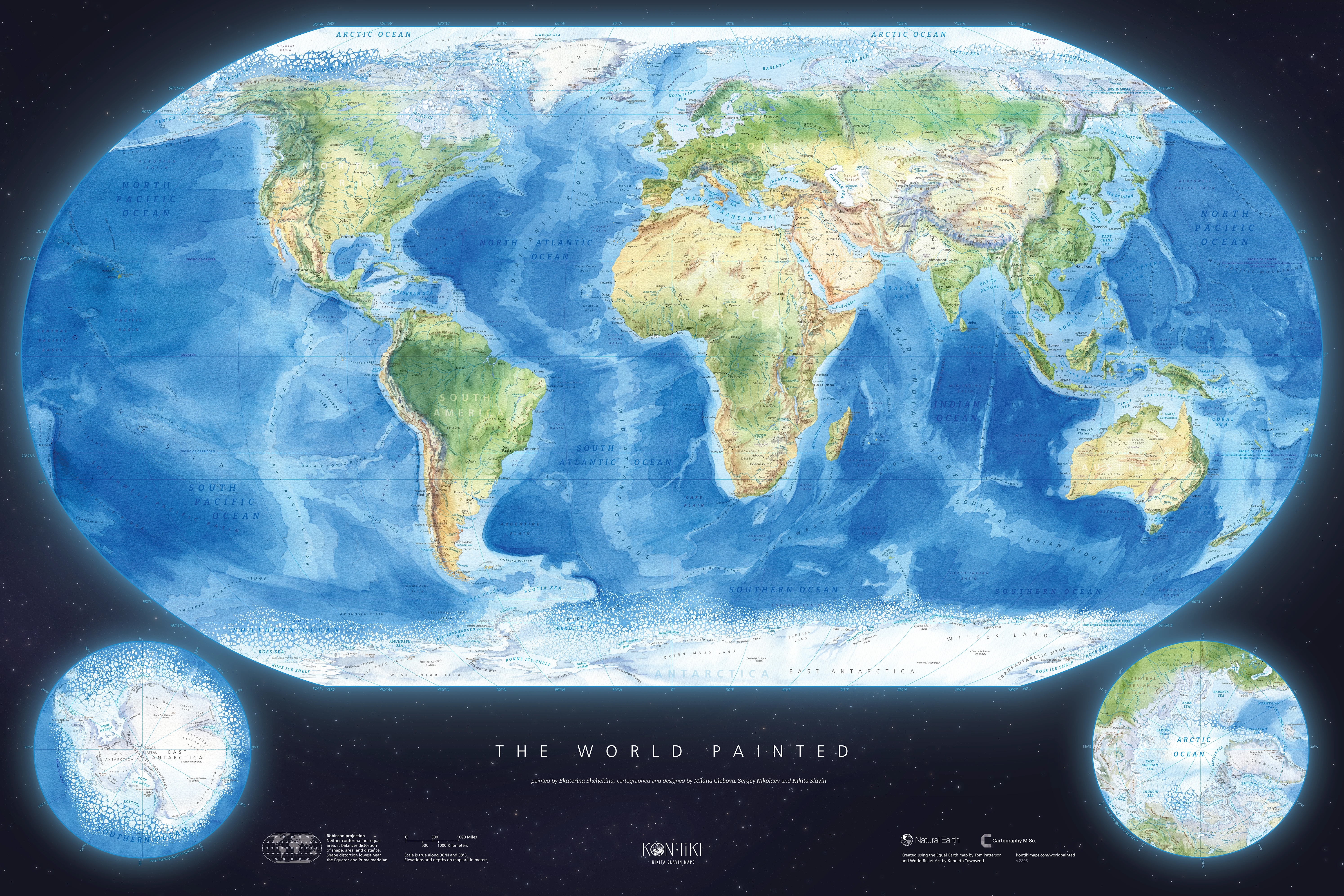
This exquisite map from the Kon-Tiki Maps team does exactly that. It fuses hand-painted watercolors and computer graphics to create a stunning map of our planet that is based on data from Natural Earth.
The map combines hand-painted colors and digital effects to create a stunning view of Earth. (Source: Kon-Tiki Maps)
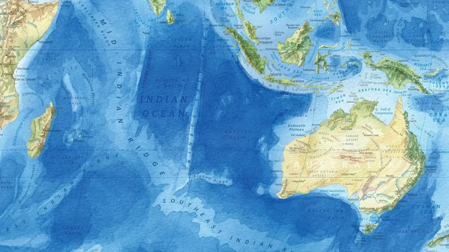
At first glance, the map appears to be a contemporary reference map of Earth. Colors reflect the physical geography of the planet. Shades of blue, green, gold, and brown differentiate landforms, bathymetric features, and topography.
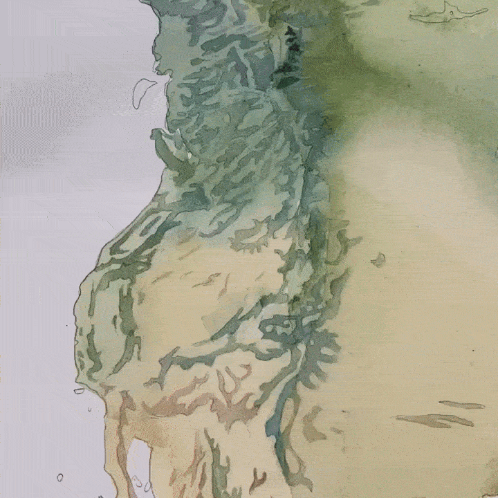
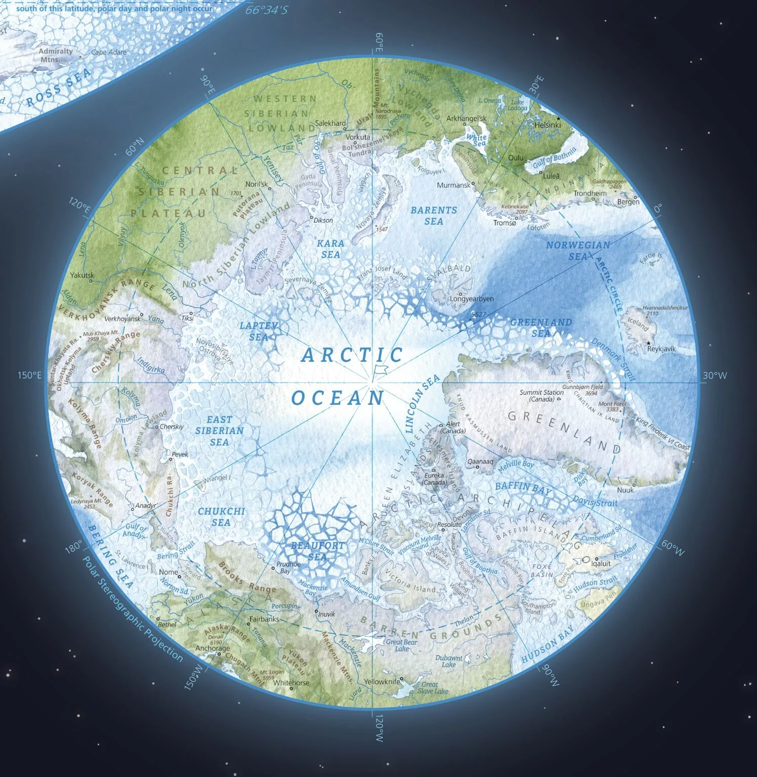
But the map invites, and practically demands, a much closer look. Zooming in, you can see sketch lines and brush strokes where colors readily bleed and merge into each other on textured paper. Labels denote cities, continents, mountain ranges and peaks, rivers, and even research stations. The edges of the map (which uses the Robinson projection) and its insets (which use the polar stereographic projection) faintly glow against a backdrop of stars, evoking Earth’s shimmering atmosphere. The insets of the north and south poles reveal splintering ice sheets.
The map is both gorgeous and functional, serving as more than just a pretty picture. Deliberately crafted shades of color communicate ocean depths and elevations on land. Fracturing ice at the poles shows where seasonal sea ice forms and dissipates each year.
The design is so well executed and intuitive that it almost obscures the rigor and craft used to create the map. The result is an easy-to-understand map of the natural world that rewards time spent poring over its details.
The map is replete with little details like fracturing ice at the edges of perennial sea ice. (Source: Kon-Tiki Maps)