
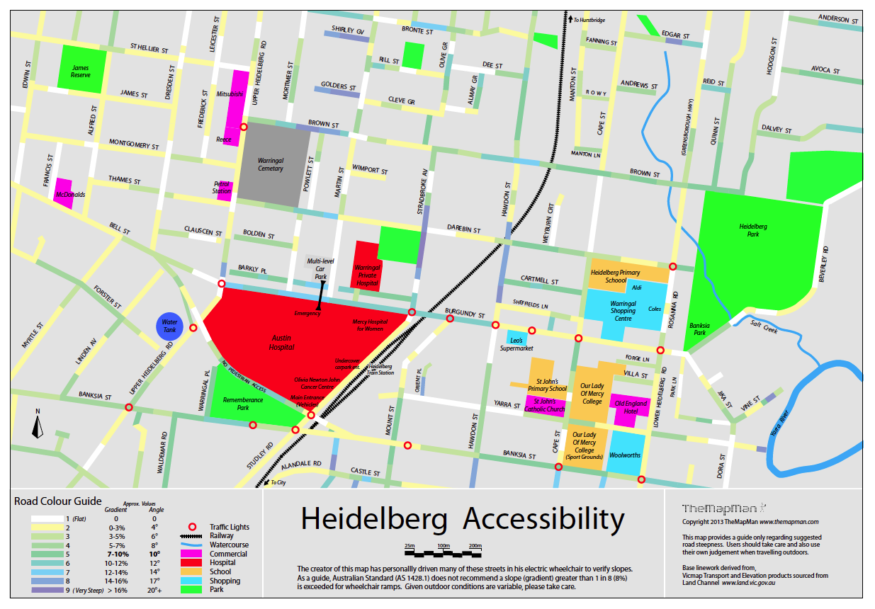
Heidelberg Accessibility Map (2013)
I developed this map in my own time based on personal field work and data from the Vic Dept. Environment & Primary Industries (www.land.vic.gov.au). The map was ceated with Adobe Illustrator.
All roads on the map have the approximate gradient shown to make getting around a little easier.
I've since supplied it to the local council, Austin Hospital and Warringal Private Hospital.
 (1.5mb PDF)
Copyright © 2016 TheMapMan